
6.4 A Line in the Sand
Explore the cultural attributes of the Arabian Peninsula and country boundary constructs.
- Define and describe the Empty Quarter.
- Explain significant elements of the treaty of Jeddah boundary agreement between Saudi Arabia and Yemen.
- Identify the physical and cultural characteristics of the Arabian Peninsula that are reflected in the new Saudi-Yemeni border agreement.
Where is the Arabian Peninsula located?
Step 1: Go to the ArcGIS Online map, A Line in the Sand, and explore it.
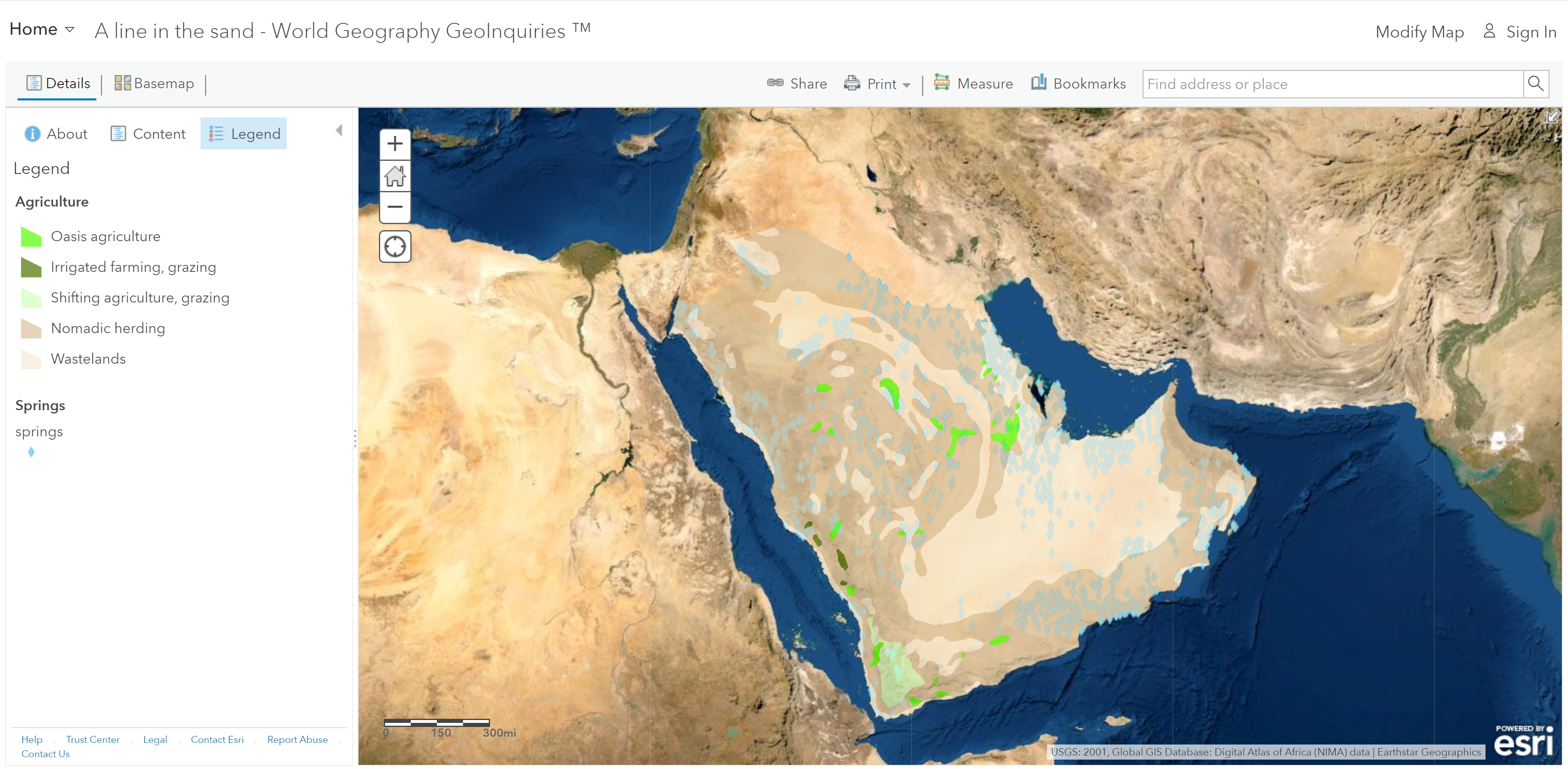
Step 2: With the Details button underlined, click the button, Show Contents.
Step 3: On the map, click the Arabian Peninsula outline. Read the pop-ups.
- Which countries form the borders with the Arabian Peninsula?
What are the population characteristics of the Arabian Peninsula?
Step 4: Check the box to the left of the layer name, Agriculture.
Step 5: Click on the layer name to see the legend.
- What is the principal agricultural activity on the peninsula?
- Agrarian activity is limited because of a lack of sufficient water for farming. (T/F)
Step 6: Turn off the Agriculture layer and then turn on the Population Density layer and view its legend.
- Most of the Arabian Peninsula has fewer than 25 people per square km, and at least half of that area includes fewer than 1 person per square km.
Step 7: Turn off the Population Density layer and turn on the Agriculture and Springs layers.
What is the Empty Quarter?
Step 8: Turn off the layer, Springs. Turn on the layer, Roads 2001; view its legend.
Step 9: View the large area with few roads in the south-central part of the peninsula. This is called the Rub ‘al-Khali or the Empty Quarter.
Step 10: Turn the following layers on and off to observe the characteristics of the Empty Quarter: Springs, Population Density, Agriculture, Temperature, and Annual Precipitation.
- What do you observe about the physical and population characteristics of the Empty Quarter?
What complicated the agreement on the border of Yemen and Saudi Arabia?
Step 11: Turn on the three layers, Yemen Boundary 1, 2, and 3. Click each line and read the text.
- What does the area between the blue and purple lines represent?
Step 12: Turn on the layer, Agriculture; view its legend.
- What is the principal economic activity of the regions in dispute?
Step 13: Turn off the layer, Agriculture. Turn on the layer, Population Density. View the legend.
- Describe the population distribution in the disputed territory.
What does the final Saudi-Yemeni Border look like?
Step 14: Zoom to the Yemen bookmark.
Step 15: Turn on two layers, Cities and Towns, and Yemen Final Border.
Step 16: Click the border and read the pop-up information.
- Does the final border go through any cities or towns? (You may need to zoom in again.)
- What are some observations about the boundary created by the Treaty of Jeddah?
