
6.2 The Arabian Peninsula
Explore the physiographic and cultural attributes of the Arabian Peninsula.
- Describe the physical characteristics of the Arabian Peninsula.
- Understand the physiographic factors that affect the countries located on the Arabian Peninsula.
Where is the Arabian Peninsula located?
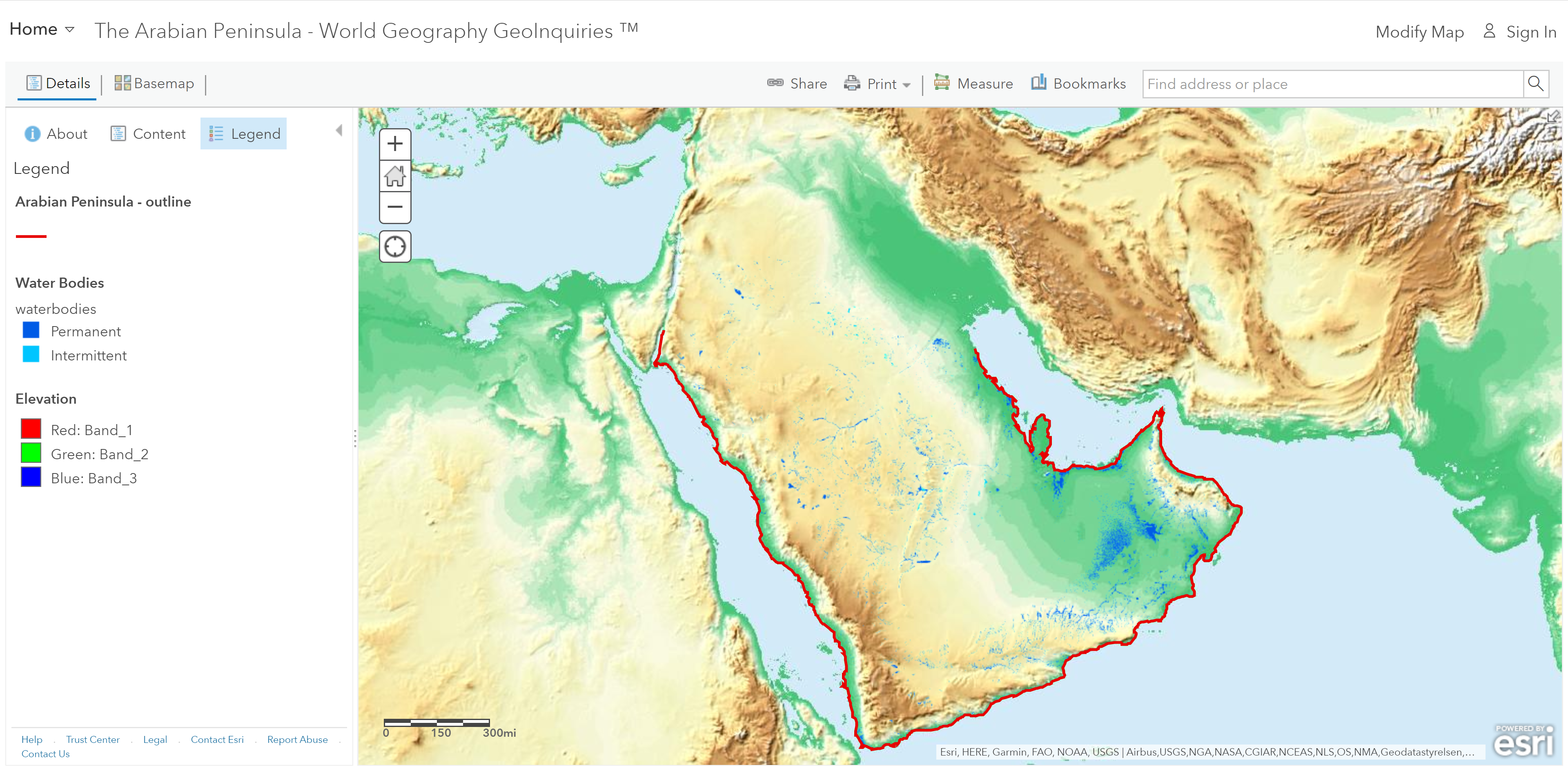
Step 1: Go to the ArcGIS Online map, The Arabian Peninsula, and explore the map.
Step 2: With the Details button underlined, click the button, Show Contents.
- Which continents surround and include the Arabian Peninsula?
What are the physical characteristics of the Arabian Peninsula?
Step 3:
- Uncheck the box to the left of the layer name, Continents. Zoom in and click several different colors of the peninsula.
- Where on the Arabian Peninsula are there more mountains?
Step 4: Turn on the layer, Water Bodies. Click the layer name.
Step 5: Click the WAter Bodies sub-layer name, and then click the Show Legend button.
Step 6: Pan and zoom the map to view the water bodies on the Arabian Peninsula.
- What types of water bodies are on the Arabian Peninsula?
Step 7: Zoom in until the Springs and Streams layer names are not grayed out, and then turn on the layers.
- Where on the Arabian Peninsula is there no water at all?
- Mountains and areas of higher elevation have more surface water. (T/F)
What type of land makes up the Arabian Peninsula?
Step 8: Turn off the layers, Water Bodies, Springs, and STreams.
Step 9: Turn on the layer, Annual Rainfall. View its legend.
One inch is equal to 25.4 millimeters. A desert is defined as a place that gets fewer than 10 inches of rain per year.
- How many millimeters is equal to 10 inches?
- Approximately what percentage of the Arabian Peninsula is desert?
What are the temperature ranges on the Arabian Peninsula?
Step 10: Turn off the layer, Annual Precipitation.
Step 11: Turn on the layer, Temp: Sept-Nov. View its legend.
Step 12: Turn the temperature layers on and off one at a time to see the changes in temperature on the Arabian Peninsula through the four seasons. (Remember, click each layer name and view its legend.)
- What is the approximate range of temperatures across the Arabian Peninsula during the hottest season?
Where would the most habitable land on the Arabian Peninsula be?
Step 13: Turn on the layer, Ecozones.
- The limited zones of temperate grassland on the Arabian Peninsula are found in the mountains, where there is more precipitation, and milder temperatures. (T/F)
Based on the map, the regions with the best habitat characteristics are the grassland ecosystems, areas with greater than 500 mm/20 inches of annual precipitation, and areas with access to permanent bodies of water or springs.
