
2.2 Trade and the Black Plague
How is Yersinia pestis (Black Death) transmitted to humans?
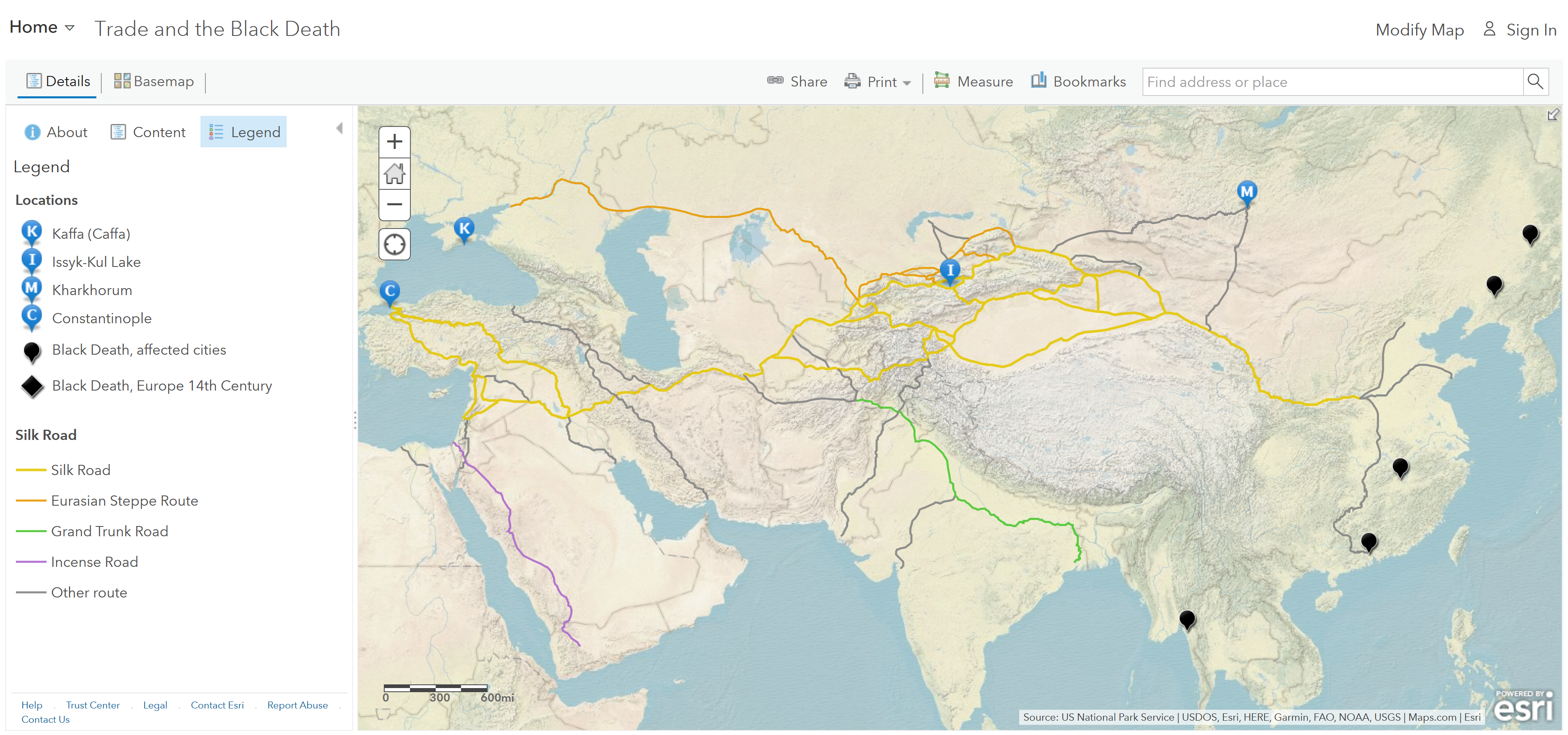
Step 1: Go to the ArcGIS Online map, Trade and the Black Death, and explore the map.
Step 2: With the Details button depressed, click the button, Content.
Step 3: Click the most southerly black pop-up located in Southeast Asia and read the information provided.
Geography Questions
- What were some factors that might have influenced the spread of the plague?
Where did the 14th century Black Plague spread?
Step 4: Click the remaining four black pop-ups (from north to south) in East Asia. Read the information provided.
Step 5: During which period did the deaths due to the plague occur n those five cities?
Step 6: Click the blue “I” Issyk-Kul Lake symbol and read the pop-up.
Step 7: Click the “M” (Kharkhorum) symbol and read the pop-up.
Geography Question
- Which direction were the Mongols and the plague traveling?
Step 8: Click the “K” symbol for the city of Kaffa (Caffa) and read the pop-up.
The Mongols, while laying siege on the capital city of Kaffa, flung infested dead bodies over the wall to spread the plague.
Where do you predict Yersinia pestis would diffuse from Kaffa?
Step 9: Turn on the layers, Maritime Silk Road, and the European Shipping Routes.
Step 10: Click the layer name to expand the legends.
Geographic Question
- How did shipping routes aid in transmitting the plague?
How did Yersinia pestis reach Europe?
Step 11: Zoom in and click the “C” symbol for the city of Constantinople and read the pop-up.
Step 12: Turn on the layer, European Overland Trade Routes.
Step 13: Click Bookmarks and choose Europe.
Geographic Question
The direction the Yersinia pestis spread from Constantinople was first along the shipping routes to trade ports along the Mediterranean Sea, and then overland from the ports into the European interior.
How prevalent was the Black Plague in Europe in the mid-1300s?
Step 14: Turn on the Black Death Cities: Europe Animation Across Europe layer.
Step 15: Stop the animation and click several of the dots from the Black Death Cities: European Animation layer.
Geographic Question
- The progression of these diseases spread the Mediterranean areas to Western Europe, north to Bavaria and Scandinavia, and then east to Russia. (T/F)
