
2.1 The Silk Roads
Where are the Silk Roads?
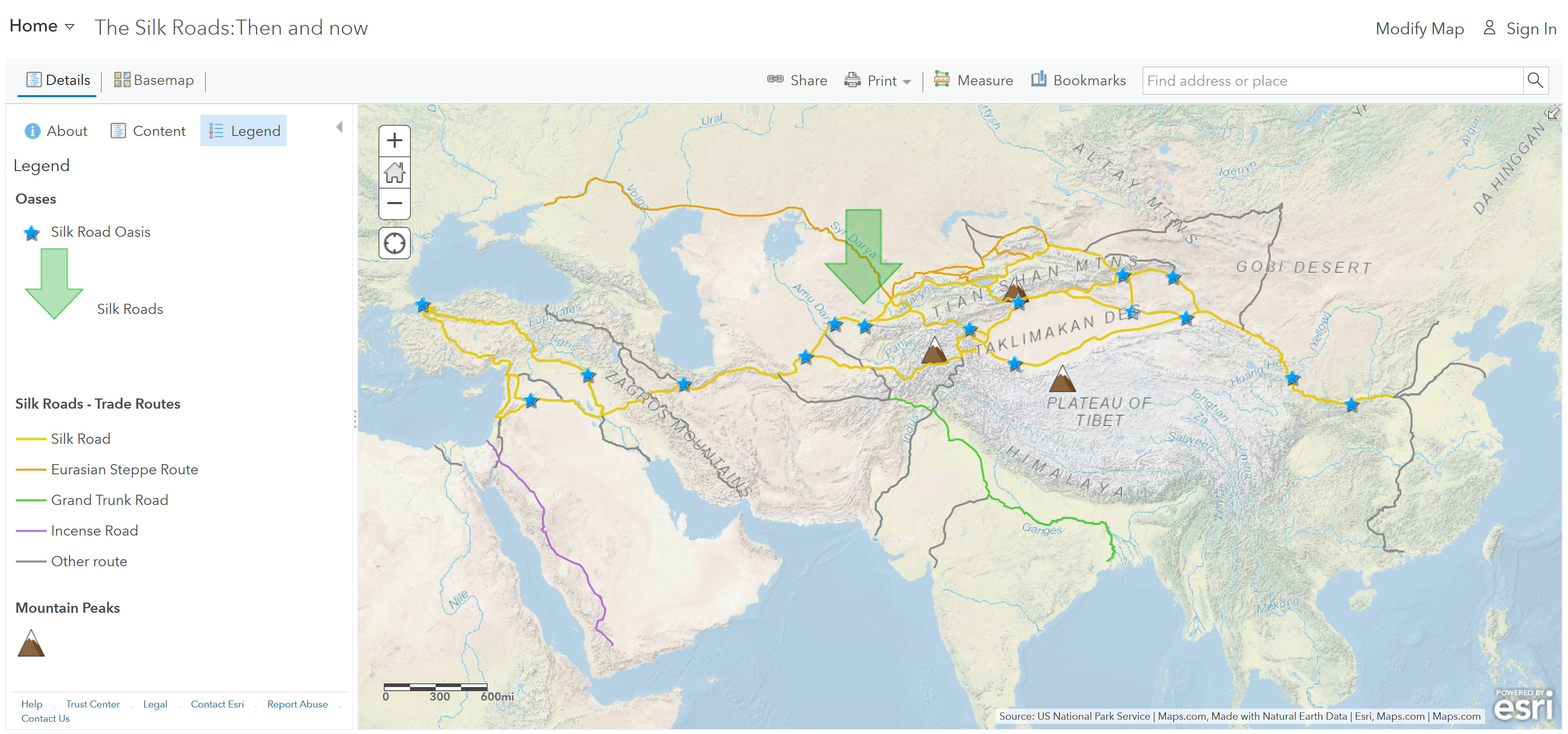
Step 1: Go to the ArcGIS Online map, The Silk Roads: Then and Now, and explore it.
Step 2: Click on the lines on the map that make up the Silk Roads – Trade Routes.
Geographic Question
- Is the Silk Road one continuous route or a network of routes?
Step 3: Click the large green arrow on the map and read the text.
How did physical geography affect the Silk Road Routes?
Step 4: With the Details button depressed, click the button, Show Contents.
Step 5: Click the checkbox to the left of the layer name, Global Biomes.
Step 6: Click the layer name, Global Biomes, to see the legend.
Geographic Questions
- Which biome has the most significant extent along the Silk Roads?
- Which biomes did the Silk Roads go around?
- What do the stars represent along the Silk Roads?
Step 7: Click the Mountains bookmarks and click the three mountain icons.
There were lots of benefits the tall mountains and rivers would provide to travelers of the Silk Roads as they traversed the deserts on this part of the Silk Roads. Tall, snowy mountains stored water that fed rivers and oases, providing water for the caravan animals and travelers.
How long would it take to traverse the Silk Roads?
Step 8: Click the button, Measure. Choose the Distance tool and set it to Miles.
Step 9: Zoom out and click the star representing the farthest west oasis (Constantinople) on the Silk Roads. Measure along the route that the oases are on to the farthest east star (Xi’an).
Step 10: Click Measure, select the Distance button, and from the drop-down list, choose a unit of measurement. Click once to start the measurement on the map, click again to change direction, and double-click to stop measuring. Hint: Position the area of interest on the map so that the Measure window does not obscure it.
Geographic Questions
- How far is it from Constantinople to Xi’an?
- If a camel could travel approximately 25 miles in a day, every day, over any terrain, how long might it have taken to travel the entire main Silk Road?
Why were there so many routes along the Silk Roads?
Recall the previous section on the physical geography along the Silk Road. They traveled in segments, from one oasis to the next, traded goods to the next caravan, and then went back the other direction with new goods.
Geographic Questions
- During these long caravan trips, what non-tangible items might have also been exchanged or diffused?
Do the Silk Roads use the routes still relevant today?
Step 10: Turn on the layer, Iron Silk Road.
Step 11: Click the Iron Silk Road on the map and read the pop-up.
Geographic Question
- The “new” railroad from Europe to Asia was coined the Iron Silk Road because it offered transport of goods, people, and ideas across the same vast continents. (T/F)
